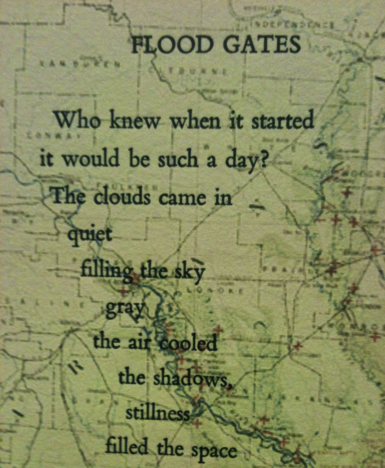
Antique maps are intricately beautiful works of art. Seeing a landscape pared down to lines and grids has a way of making it more intimate while also expanding it's scale beyond the realistically visible. With some imagination, these maps tell a story. This week's book, Flood Gates, is an altered form of a previous book-of-the-week, Week 25, 2014, Flood Gates (http://paperbuttons.blogspot.com/2014/06/week-25-flood-gates.html). The current Flood Gates is set in a specific place, the Mississippi River... after the Great Flood of 1927. The poem is a letterpress-printed broadside over a copy of the historic 1927 map of the flooded areas and relief operations.
 |
| the entire broadside, 18 x 7 inches |
 |
| original map, Records of the Coast and Geodetic Survey |
The Great Mississippi Flood of 1927 affected 7 states (Arkansas, Illinois, Kentucky, Louisiana, Mississippi, Missouri, Tennessee, Texas, Oklahoma and Kansas) and was the most destructive flood in the history of the United States. John M. Barry describes the flood and its destruction in his book, Rising Tide: The Great Mississippi Flood of 1927 and How It Changed America. Over 250 people died, hundreds of thousands of people were displaced, and over 27,000 acres were flooded after the river rose and over 145 levees broke.
An unusually wet summer in 1926 led to a swollen Mississippi river and tributaries in Iowa and Kansas overflowing by September. On Christmas Day, 1926, the Cumberland River in Nashville, Tennessee was at 56 ft, still the highest point ever. On April 15, 1927, Good Friday, rains began falling over Missouri, Illinois, Arkansas, Mississippi, Texas, and Louisiana. In New Orleans, they were recorded to have lasted for 18 hours. All along the river, people worked to build up the levees. On April 21 the first levee broke at Mounds Landing, Mississippi. Waters rushed through the three quarter-mile crevass at the same force as the waters of Niagra Falls. Flooding extended 60 miles east and 90 miles south. Over 185,000 people were displaced from this area alone. A PBS documentary describes the flooding and human conditions in Greenville, MS near Mounds Landing (PBS Documentary). In addition to the property destruction was the tragedy of human condition and reaction towards the African American population during the flooding and recovery period. A large exodus of the African American population out of Mississippi and into the Northern cities followed... National Geographic describes the flood and some of the outrageous choices in its article, Man vs Nature.
Though all floods are catastrophic, this particular flood map seemed most appropriate to cover all of the untold stories behind the words of the poem, Flood Gates. The map was inkjet printed onto Rives BFK paper with an Epson printer. The typeface used for printing the poem was 14-point Bembo and the poem was printed on a Vandercook letterpress at Penland School of Crafts in Penland, North Carolina. Ink color was selected from the Pantone Color Guide to match the river on the original map.
 |
| mixing the ink |
 |
| lines of type in the pressbed |
 |
| titles, map and poem |
 |
| the first stanza.. |
 |
| meandering lines of type.. like the river |
 |
| the poem.. on two banks |
 |
| moving along the river way... |
This is the poem.
Flood Gates
Who knew when it started
it would be such a day?
The clouds came in
quiet
filling the sky
gray
the air cooled
the shadows,
stillness
filled the space
In the distance thunder
rumbled...
electricity
moved through the air
as if the gods were whispering
their heavenly
beware.
The first drops
fell
big and sloppy
playfully splattering,
plopping and pinging
the sidewalks and lawns,
forests, highways,
and farms
Meanwhile the thunder
grew louder,
its growl more insistent
with snap cracks
of lightening
that startled the nerves
frightened the little babies
...and the old folks too.
The wind blew the rain
sideways
sent hats a-flying
and umbrellas turned
upward
like tea cups scared stiff
Then the rain came in
sure and drenching...
pouring sheets and sheaths
that were flapping and waving
like clothes on the line...
washing away the refuse,
the dust and the grime
So the drivers slowed down
it was that hard to see
and the walkers took shelter
on porches, and in doorways,
under bridges, and trees
looking for cover
as quick as could be.
Still the water
kept coming
the rain never ceased...
the torrents above
and the deluge below
It was a world washed
in wetness
...the sky gods were weeping
and everything not sheltered
was soaked, sodden, or
floating...
and the mud just
kept rising
because
the flood gates
had opened.
Who knew
when it started
it would be such
a day?
 |
| Lake Village, Arkansas, 1927 |


No comments:
Post a Comment